Exploração Mineral
Como uma mina nasce: da busca regional ao conceito de recurso e reserva.
Introdução
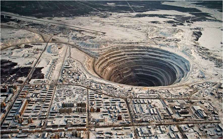
Quando vemos uma mina em operação, como na figura 1, não imaginamos o longo trabalho prévio que foi necessário para que essa mina fosse viabilizada.
Até identificarmos um depósito mineral e consequentemente colocarmos em produção uma mina, buscando recursos naturais extremamente úteis para as necessidades da sociedade moderna, foi necessário um contínuo, longo1, caríssimo, multidisciplinar, complexo e arriscado2 processo denominado Exploração Mineral3.
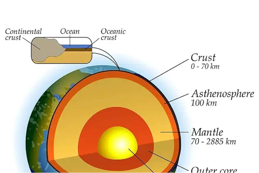
Para se ter uma ideia da ordem de grandeza, o principal desafio dos exploradores minerais é identificar uma concentração mineral anômala4, economicamente explotável, de aproximadamente 10 km² numa superfície emersa de aproximadamente 150 milhões de km² e com até 10 km de espessura na Crosta. E o desafio atual é tentar encontrar jazidas ainda mais profundas, pois as rasas, quase sem exceção, já foram descobertas. Por isso, é uma atividade que, apesar das novas tecnologias, tem se tornado mais cara e exigente de habilidades específicas, devido ao novo desafio5.
A atividade de exploração mineral é regida pela dicotomia risco-recompensa e por isso, boa parte dos investimentos em exploração atualmente, em volume, são direcionados para poucos recursos minerais de maior retorno econômico como ouro, cobre, diamante, petróleo e gás6. Porém, do ponto de vista estratégico e das necessidades da indústria e da população, todos os demais recursos minerais, apesar de relativamente menos atrativos economicamente, têm a mesma importância dos anteriores.
Da Atividade
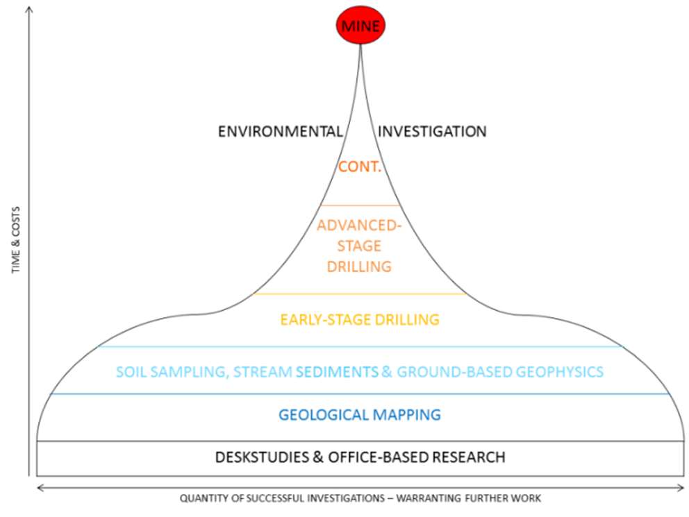
Os trabalhos de exploração mineral são contínuos, sistemáticos e por estágios. As atividades de busca de alvos minerais favoráveis iniciam com o reconhecimento, em mapas, de regiões com potenciais concentrações anômalas, passando pelo requerimento de pesquisa de um perímetro predefinido junto aos órgãos federais7, mapeamento, pesquisa geofísica, perfuração de poços, trincheiras, análise química, etc. Todos esses estágios exigem mão de obra especializada, técnicas específicas e tecnologicamente avançadas.
A cada estágio superado, aumentam os custos e o tempo, porém aumenta também a probabilidade de descoberta de uma nova jazida mineral. E a decisão de continuar os trabalhos de exploração, buscando o próximo estágio, depende do potencial geológico interpretado por especialistas e da disponibilidade de recursos financeiros.
Uma vez concluídos todos os estágios exploratórios e quantificada uma eventual jazida mineral, é introduzida a fase mais custosa e arriscada, que é a decisão de transformar a recém-descoberta jazida em lavra. Para isso, é necessário avaliar as variáveis econômicas, jurídicas, políticas, tecnologias disponíveis e ambientais. Por isso, além de todos os desafios técnicos, existem diversas outras barreiras que fogem ao controle dos técnicos da área de mineração, geologia e engenharia de minas; não por outro motivo, a Exploração Mineral é talvez a mais multidisciplinar das atividades econômicas.
Lembrando que os trabalhos dos técnicos terminam apenas depois de concluída a explotação do recurso mineral e do descomissionamento da lavra.
A exploração mineral difere de diversas outras atividades econômicas por ser intensiva em capital, contínua, com uso intensivo de métodos tecnológicos avançados (métodos geofísicos) e, principalmente, mão de obra extremamente especializada.
Métodos de Exploração Mineral
O trabalho de exploração mineral resume-se na procura e identificação de anomalias físicas e químicas nas rochas e/ou solos. Uma vez identificada a anomalia, é necessário avaliar e quantificar o volume da eventual descoberta e, por fim, determinar a viabilidade econômica da descoberta.
As rochas na crosta terrestre8 são heterogêneas do ponto de vista físico e composicional e, por isso, apresentam diferenças de propriedades físicas, como densidade, condutividade elétrica, propriedades magnéticas, impedância acústica etc. Os exploradores, num primeiro momento, procuram essas anomalias físicas, e os métodos para identificá-las baseiam-se nas diferenças das propriedades físicas das rochas e minerais: pequenas diferenças de densidade, cor, condutividade elétrica, propriedades magnéticas, acústicas, eletromagnéticas etc. Para isso, lança-se mão das técnicas geofísicas (e naturalmente físicas), que exigem mão de obra especializada.
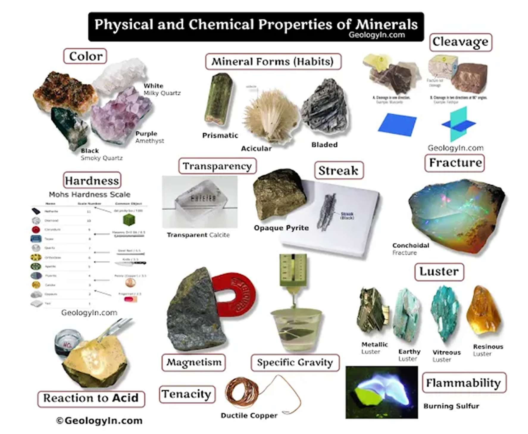
As etapas exploratórias, de maneira sintética, são:
- a) Reconhecimento Regional: usando os mapas e dados públicos disponíveis, principalmente de órgãos estatais e empresas, bancos de dados públicos, fotos de satélite, mapas geológicos de pequena escala (regionais) etc., sobretudo os dados da CPRM9, no sentido de buscar potenciais anomalias e potenciais áreas-alvo. As escalas nesta fase variam de 1:1.000.000 a 1:100.000. Prazo: até um ano.
- b) Prospecção: busca por áreas específicas mineralizadas, já lançando mão de técnicas locais de geofísica e geoquímica, além de mapeamento em escala local (grande escala). É nesta etapa também que se obtém o requerimento de pesquisa (prospecting licence). Nesta segunda etapa trabalha-se com escalas de 1:50.000 a 1:25.000, já em UTM. Prazo: de até 3 anos.
- c) Avaliação ou exploração de detalhe: é o momento de coletar, qualificar e quantificar um eventual depósito mineral em três dimensões: as rochas encaixantes, a presença de fraturas/falhas, o tipo de jazimento, as possíveis continuidades e a dureza das rochas10, com perfurações sistemáticas, análises químicas, uso de modelos geoestatísticos etc. E, por fim, declarar a comercialidade, caso se entenda que há viabilidade econômica. As escalas nesta última fase variam de 1:10.000 até 1:1.000 e os prazos são de 2 a 6 anos.
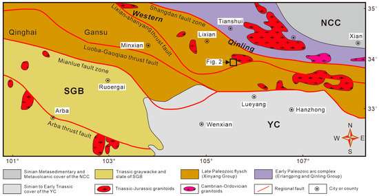
Conceito de Recurso e Reserva segundo a CBRR11
Para alguns pode parecer redundante, para outros pode parecer complicado; por isso é necessário, antes de seguirmos em frente, reforçar os conceitos acima.
Recurso: é um volume sólido/líquido tridimensional mensurado de um determinado bem mineral, que foi avaliado sob a ótica geométrica e geológica, como teor, concentração, dimensão, continuidade, profundidade, presença ou ausência de fraturas/falhas etc. Porém, não foi submetido a uma avaliação econômica. É classificado, em ordem crescente de confiabilidade e volume de dados, como recurso inferido, indicado e medido. É o resultado do trabalho de pesquisa mineral, no qual o Relatório Final de Pesquisa é apresentado ainda como recurso.
Reserva: é a parte ou o todo do recurso indicado e/ou medido, submetido a avaliação técnica adequada, levando em consideração variáveis como preços, tecnologias, legislação, tributação, custos, infraestrutura disponível e a construir etc., que pode ser extraído com lucro. É também subdividida, em ordem crescente de confiabilidade, em reserva provável e provada.
Mineral Exploration
How a mine comes to be: from regional search to the concepts of resource and reserve.
Introduction
When we see a mine in operation, as in figure 1, we do not imagine the long preliminary work that was needed to make that mine viable.
Before a mineral deposit is identified and a mine is put into production, in search of natural resources that are extremely useful to modern society, a continuous, long1, very expensive, multidisciplinary, complex and risky2 process is required, called Mineral Exploration3.
To get an idea of the order of magnitude, the main challenge of mineral explorers is to identify an anomalous mineral concentration4, economically exploitable, of roughly 10 km² on an emerged surface of roughly 150 million km² and up to 10 km thick in the Crust. The current challenge is to try to find even deeper deposits, because the shallow ones have, almost without exception, already been discovered. For this reason, despite new technologies, it is an activity that has become more expensive and demanding of specific skills, because of this new challenge5.
Mineral exploration is governed by the risk–reward dichotomy, and so a large part of current exploration investment, by volume, is directed to a few mineral resources with the highest economic return, such as gold, copper, diamond, oil and gas6. From the strategic point of view, however, and from the needs of industry and the population, all other mineral resources, although relatively less attractive economically, are just as important as those.
About the Activity
Mineral exploration work is continuous, systematic and carried out in stages. The search for favourable mineral targets begins with the recognition, on maps, of regions with potential anomalous concentrations, and goes on through the exploration application for a predefined perimeter with the federal authorities7, mapping, geophysical survey, drilling of wells, trenches, chemical analysis, and so on. All of these stages require specialised labour and specific, technologically advanced techniques.
With each stage completed, costs and time increase, but so does the probability of discovering a new mineral deposit. The decision to continue the exploration work toward the next stage depends on the geological potential as interpreted by specialists and on the availability of financial resources.
Once all the exploration stages are complete and a possible mineral deposit has been quantified, the most costly and risky phase begins: the decision to turn the newly discovered deposit into a mine. This requires evaluating the economic, legal, political, technological and environmental variables. So, besides all the technical challenges, there are several other barriers that are beyond the control of mining, geology and mining-engineering technicians; for this very reason, Mineral Exploration is perhaps the most multidisciplinary of economic activities.
It should be remembered that the technicians’ work ends only after the exploitation of the mineral resource is complete and the mine has been decommissioned.
Mineral exploration differs from many other economic activities in being capital-intensive and continuous, with heavy use of advanced technological methods (geophysical methods) and, above all, extremely specialised labour.
Mineral Exploration Methods
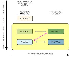
Mineral exploration work comes down to searching for and identifying physical and chemical anomalies in rocks and/or soils. Once an anomaly is identified, it is necessary to assess and quantify the volume of the possible discovery and, finally, to determine its economic viability.
Rocks in the Earth’s crust8 are heterogeneous in physical and compositional terms and therefore differ in physical properties such as density, electrical conductivity, magnetic properties, acoustic impedance and so on. Explorers first look for these physical anomalies, and the methods for identifying them rely on the differences in the physical properties of rocks and minerals: small differences in density, colour, electrical conductivity, magnetic, acoustic, electromagnetic properties and so on. Geophysical (and naturally physical) techniques are used for this, and they require specialised labour.
In summary, the exploration stages are:
- a) Regional reconnaissance: using the available maps and public data, mainly from state bodies and companies, public databases, satellite photos, small-scale (regional) geological maps and so on, above all CPRM data9, in order to look for potential anomalies and potential target areas. Scales in this phase range from 1:1,000,000 to 1:100,000. Duration: up to one year.
- b) Prospecting: the search for specific mineralised areas, already using local geophysical and geochemical techniques, as well as local-scale (large-scale) mapping. This is also the stage at which the exploration application (prospecting licence) is obtained. In this second stage, scales of 1:50,000 to 1:25,000 are used, already in UTM. Duration: up to 3 years.
- c) Evaluation or detailed exploration: the time to collect, qualify and quantify a possible mineral deposit in three dimensions: the host rocks, the presence of fractures/faults, the type of occurrence, possible continuities and the hardness of the rocks10, with systematic drilling, chemical analyses, geostatistical models and so on. Finally, commerciality is declared if the deposit is judged economically viable. Scales in this last phase range from 1:10,000 to 1:1,000 and durations are 2 to 6 years.
Concept of Resource and Reserve according to the CBRR11
To some this may seem redundant, to others complicated; so, before moving on, it is necessary to reinforce the concepts above.
Resource: a measured three-dimensional solid/liquid volume of a given mineral commodity that has been evaluated from the geometric and geological point of view, such as grade, concentration, size, continuity, depth, presence or absence of fractures/faults and so on. It has not, however, been subjected to an economic evaluation. It is classified, in increasing order of reliability and volume of data, as inferred, indicated and measured resource. It is the result of the mineral exploration work, in which the Final Exploration Report is still presented as a resource.
Reserve: the part or the whole of the indicated and/or measured resource that has undergone a suitable technical evaluation, taking into account variables such as prices, technologies, legislation, taxation, costs, available and to-be-built infrastructure and so on, and that can be extracted at a profit. It is also subdivided, in increasing order of reliability, into probable and proved reserve.
Минерально-сырьевая разведка
Как появляется рудник: от региональных поисков до понятий «ресурс» и «запас».
Введение
Когда мы видим действующий рудник, как на рисунке 1, мы не представляем, какая долгая предварительная работа потребовалась, чтобы сделать его возможным.
Прежде чем будет выявлено месторождение и запущен рудник, добывающий природные ресурсы, крайне нужные современному обществу, необходим непрерывный, долгий1, очень дорогой, многопрофильный, сложный и рискованный2 процесс, который называется минерально-сырьевой разведкой3.
Чтобы представить масштаб: главная задача разведчиков — найти аномальную концентрацию минерала4, пригодную для экономически оправданной добычи, площадью около 10 км² на суше площадью около 150 млн км² и в слое коры толщиной до 10 км. Сейчас задача — найти ещё более глубокие залежи, потому что неглубокие, почти без исключения, уже открыты. Поэтому, несмотря на новые технологии, эта работа стала дороже и требует особых навыков из-за новой задачи5.
Разведка подчиняется дилемме «риск — вознаграждение», поэтому большая часть нынешних инвестиций в разведку по объёму направляется на немногие ресурсы с наибольшей отдачей: золото, медь, алмазы, нефть и газ6. Но со стратегической точки зрения и с точки зрения нужд промышленности и населения все остальные полезные ископаемые, хотя и менее привлекательны экономически, так же важны, как и эти.
О работах
Разведочные работы непрерывны, систематичны и ведутся по стадиям. Поиск перспективных участков начинается с выявления на картах районов с возможными аномальными концентрациями, затем идут заявка на разведку заранее определённого периметра в федеральных органах7, картирование, геофизические исследования, бурение скважин, проходка траншей, химический анализ и т. д. Все эти стадии требуют квалифицированных специалистов и специальных, технологически современных методов.
С каждой пройденной стадией растут затраты и время, но растёт и вероятность открытия нового месторождения. Решение продолжать разведку и переходить к следующей стадии зависит от геологического потенциала, оценённого специалистами, и от наличия финансовых средств.
Когда все стадии разведки завершены и возможное месторождение оценено количественно, начинается самая затратная и рискованная фаза: решение превратить только что открытое месторождение в рудник. Для этого нужно оценить экономические, юридические, политические, технологические и экологические переменные. Поэтому помимо технических задач существует множество других барьеров, не зависящих от горняков, геологов и горных инженеров; не случайно минерально-сырьевая разведка — пожалуй, самая многопрофильная из экономических видов деятельности.
Следует помнить, что работа специалистов заканчивается только после полной отработки полезного ископаемого и вывода рудника из эксплуатации.
Разведка отличается от многих других видов деятельности тем, что она капиталоёмка и непрерывна, широко использует передовые технологические методы (геофизику) и, главное, требует узкоспециализированных кадров.
Методы минерально-сырьевой разведки
Разведка сводится к поиску и выявлению физических и химических аномалий в породах и/или почвах. После выявления аномалии нужно оценить и количественно определить объём возможного открытия и, наконец, определить его экономическую целесообразность.
Горные породы земной коры8 неоднородны по физическим свойствам и составу, поэтому различаются плотностью, электропроводностью, магнитными свойствами, акустическим импедансом и т. д. Сначала разведчики ищут именно эти физические аномалии, а методы их выявления основаны на различиях физических свойств пород и минералов: небольших различиях плотности, цвета, электропроводности, магнитных, акустических, электромагнитных свойств и др. Для этого применяются геофизические (и, естественно, физические) методы, требующие квалифицированных специалистов.
Стадии разведки в кратком виде:
- а) Региональное рекогносцировочное изучение: по имеющимся картам и открытым данным, главным образом государственных органов и компаний, открытым базам данных, спутниковым снимкам, мелкомасштабным (региональным) геологическим картам и т. д., прежде всего по данным CPRM9, для поиска возможных аномалий и перспективных площадей. Масштабы на этой стадии от 1:1 000 000 до 1:100 000. Срок: до одного года.
- б) Поиски: поиск конкретных минерализованных участков с применением локальных геофизических и геохимических методов, а также картирования в крупном масштабе. На этой стадии оформляется и разрешение на разведку (prospecting licence). Масштабы от 1:50 000 до 1:25 000, уже в системе UTM. Срок: до 3 лет.
- в) Оценка, или детальная разведка: время собрать, охарактеризовать и количественно оценить возможное месторождение в трёх измерениях: вмещающие породы, наличие трещин и разломов, тип залегания, возможную протяжённость и твёрдость пород10 — с систематическим бурением, химическими анализами, геостатистическими моделями и т. д. В конце заявляется коммерческая ценность, если месторождение признано экономически целесообразным. Масштабы на этой последней стадии от 1:10 000 до 1:1 000, срок от 2 до 6 лет.
Понятия «ресурс» и «запас» по CBRR11
Кому-то это покажется лишним, кому-то сложным; поэтому, прежде чем идти дальше, нужно закрепить приведённые выше понятия.
Ресурс — измеренный трёхмерный объём твёрдого/жидкого полезного ископаемого, оценённый с геометрической и геологической точек зрения: содержание, концентрация, размеры, протяжённость, глубина, наличие или отсутствие трещин и разломов и т. д. Но экономической оценке он не подвергался. Ресурсы классифицируются по возрастанию достоверности и объёма данных на предполагаемые, выявленные и измеренные. Это итог разведочных работ: Итоговый отчёт о разведке подаётся ещё как оценка ресурса.
Запас — часть или весь выявленный и/или измеренный ресурс, прошедший надлежащую техническую оценку с учётом цен, технологий, законодательства, налогообложения, затрат, имеющейся и будущей инфраструктуры и т. д., который можно извлечь с прибылью. Запасы тоже подразделяются по возрастанию достоверности на вероятные и доказанные.
Métodos Exploratórios
Do levantamento regional à perfuração: as ferramentas da exploração mineral.
Levantamento Regional: usando os mapas e dados geológicos já existentes em pequenas escalas1, é possível buscar áreas prospectáveis para iniciar o processo de busca de objetivos mineralizados.
Sensoriamento Remoto: os satélites atuais disponibilizam, cada vez mais, imagens extremamente detalhadas, algumas vezes gratuitas ou baratas, em escalas cada vez maiores de toda a superfície da Terra e com ainda mais regularidade. Além disso, temos hoje, de maneira barata e acessível, drones que podem refinar e corroborar ainda mais as imagens dos satélites. Esses dados são fundamentais na fase de prospecção mineral e serão integrados aos dados disponíveis para futura interpretação e mapeamento.
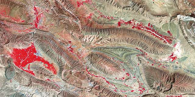
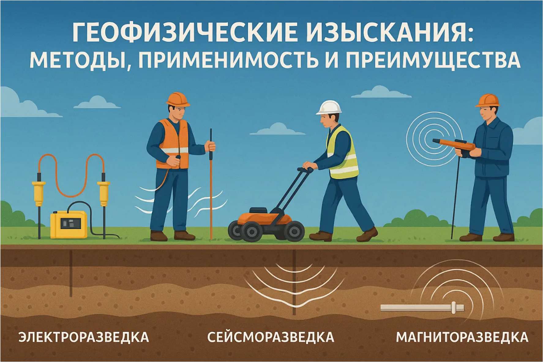
Levantamentos Geofísicos: é a determinação das anomalias das propriedades físicas das rochas e do solo na superfície e na subsuperfície, usando uma série de equipamentos disponíveis no mercado e também levantamentos prévios disponíveis em algumas regiões. Os levantamentos geofísicos podem ser obtidos por drones, aviões, helicópteros e, principalmente, em escala maior, porém mais caros e de baixo rendimento, na própria superfície.
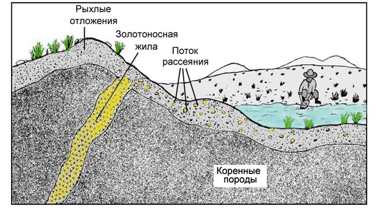
Amostragem Geoquímica: são análises químicas sistemáticas, principalmente de solos e de sedimentos ao longo dos rios, buscando, a montante, a rocha-mãe/depósito mineralizado e/ou, ao redor, o eventual depósito mineralizado.
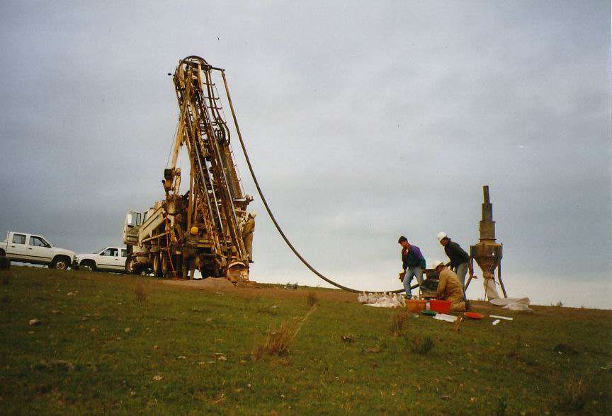
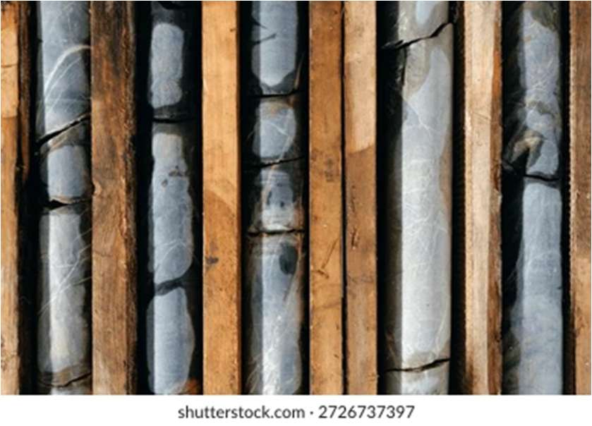
Perfuração: é a etapa mais cara e de maior risco da exploração mineral. É o momento de identificar a eventual mineralização e fazer as análises químicas para quantificar o corpo mineralizado, para posterior declaração de comercialidade, e de definir o método de lavra a ser usado a partir dos dados obtidos dos testemunhos de sondagem.
Exploration Methods
From regional survey to drilling: the tools of mineral exploration.
Regional survey: using geological maps and data that already exist at small scales1, it is possible to look for prospectable areas in order to start the search for mineralised targets.
Remote sensing: today’s satellites provide ever more extremely detailed images, sometimes free or cheap, at ever larger scales of the entire surface of the Earth and with even greater regularity. In addition, we now have drones, cheap and accessible, that can refine and further corroborate the satellite images. These data are fundamental in the mineral prospecting phase and will be integrated with the available data for later interpretation and mapping.
Geophysical surveys: the determination of anomalies in the physical properties of rocks and soil at the surface and subsurface, using a range of equipment available on the market and also earlier surveys available in some regions. Geophysical surveys can be obtained by drones, aircraft, helicopters and, mainly, on a larger scale but at higher cost and lower productivity, at the surface itself.
Geochemical sampling: systematic chemical analyses, mainly of soils and of sediments along rivers, searching upstream for the source rock/mineralised deposit and/or around the possible mineralised deposit.
Drilling: the most expensive and riskiest stage of mineral exploration. This is when the possible mineralisation is identified and chemical analyses are made to quantify the mineralised body, for a later declaration of commerciality, and when the mining method to be used is defined from the data obtained from the drill cores.
Методы разведки
От регионального изучения до бурения: инструменты минерально-сырьевой разведки.
Региональное изучение. По уже имеющимся геологическим картам и данным мелких масштабов1 можно найти перспективные площади, с которых начинается поиск минерализованных объектов.
Дистанционное зондирование. Современные спутники всё чаще дают чрезвычайно подробные снимки, иногда бесплатные или недорогие, во всё более крупных масштабах на всю поверхность Земли и со всё большей регулярностью. Кроме того, сегодня есть недорогие и доступные дроны, которые могут уточнить и дополнительно подтвердить спутниковые снимки. Эти данные важны на стадии поисков и будут объединены с имеющимися данными для последующей интерпретации и картирования.
Геофизические съёмки. Это определение аномалий физических свойств пород и почвы на поверхности и в недрах с помощью оборудования, имеющегося на рынке, а также по ранее выполненным съёмкам, доступным в некоторых регионах. Геофизические данные можно получать с дронов, самолётов, вертолётов и, главным образом, в более крупном масштабе — но дороже и с меньшей производительностью — на самой поверхности.
Геохимическое опробование. Систематические химические анализы, главным образом почв и речных осадков: по течению вверх ищут коренную породу/рудное месторождение и/или обследуют окрестности возможного рудного месторождения.
Бурение. Самый дорогой и рискованный этап разведки. На нём выявляют возможную минерализацию и делают химические анализы, чтобы количественно оценить рудное тело, — для последующего заявления о коммерческой ценности, — и по данным керна определяют способ добычи.
Riscos associados à Exploração Mineral
Riscos geológicos, tecnológicos, ambientais, jurídicos, políticos e econômicos, além da segurança do trabalho.
Riscos Geológicos: apesar de os elementos químicos terem uma distribuição previsível na Crosta, por uma infinidade de fatores algumas regiões têm mais chance de se descobrir uma jazida do que outras. Por exemplo, o clima1 exerce um papel fundamental na distribuição: acumulações de bauxita2 tendem a ocorrer em regiões equatoriais/tropicais; cobre, prata e molibdênio tendem a se enriquecer em regiões orogênicas atuais, como os Andes; vanádio, em diques de diabásio como em Botsuana; diamantes têm mais chances de serem encontrados em regiões cratônicas da Sibéria, Austrália, Canadá e África do Sul; ouro tem mais chance de ocorrer em cinturões arqueanos de rochas verdes3; petróleo e gás tendem a se acumular em bacias sedimentares com espessuras maiores que 4 km, e assim sucessivamente.
Logo, o trabalho dos especialistas não é aleatório. Por isso, quanto mais expertise, quanto mais tecnologias e informações disponíveis e quanto mais discussão entre as equipes, com diferentes graus de experiência, menor tende a ser o risco geológico. A chave do sucesso é a multidisciplinaridade e a continuidade. Um insucesso hoje pode nos direcionar a um sucesso nos arredores num futuro próximo, devido à curva de aprendizado. Outra variável importante é a confiabilidade dos dados geológicos; por isso, as equipes de mineração, do sondador ao consultor, passando pelos técnicos, precisam ser extremamente capacitadas.
Tecnologias Disponíveis: tanto na exploração mineral quanto na explotação (fase de lavra) e no descomissionamento futuro de uma eventual mina, as tecnologias estão em constante avanço e, eventualmente, ficando mais baratas. Por isso, é preciso levar em consideração que o surgimento de uma nova tecnologia pode transformar um recurso em reserva, ou vice-versa, e naturalmente viabilizar ou inviabilizar uma nova mina, ou até dar sobrevida a uma mina atual que, para as tecnologias atuais, deveria ser fechada. Por outro lado, novas tecnologias podem tornar as atuais obsoletas e não econômicas. Um custo sensível às novas tecnologias é o de cominuição, devido ao surgimento de equipamentos de trituração cada vez mais eficientes e baratos.
Riscos Ambientais, Jurídicos e Políticos: as exigências ambientais na indústria mineral já são altas e têm aumentado, e a fiscalização costuma ser extremamente rigorosa e eficiente devido às novas técnicas disponíveis. Além disso, a segurança jurídica é extremamente relevante, pois uma empresa não pode ser punida por decisões políticas póstumas. Logo, os especialistas não podem ignorar essas variáveis já no início do projeto; elas devem ser incluídas para que não haja surpresas numa eventual descoberta no futuro.
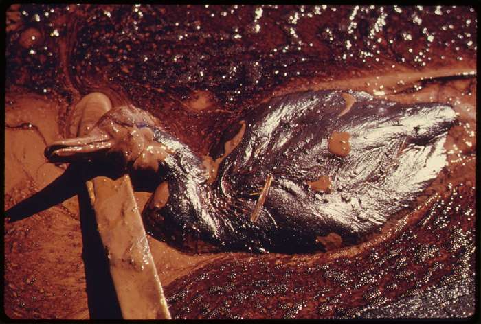
Riscos Econômicos: depois do risco geológico, é talvez a variável mais importante a ser considerada, não apenas pela dificuldade de descobrir uma eventual jazida, mas principalmente porque, uma vez descoberta e avaliada, as variáveis podem mudar a qualquer momento, seja pela própria dinâmica dos preços internacionais das commodities, seja por alterações de exigências que podem surgir no curso de uma mina já em atividade, como aumento de taxas, royalties e impostos, restrições ambientais, alteração de exigências técnicas e até cassação da concessão de lavra por mudanças políticas. No Brasil, apesar de o empreendedor deter o direito da Concessão de Lavra, existe a necessidade de acordo com o superficiário da jazida. Depende também da disponibilidade e do custo da energia, da infraestrutura até os mercados consumidores/exportadores e do mercado consumidor interno.
Lembrando que, para um empreendimento de mineração começar a usufruir dos lucros, são necessários pelo menos 20 anos contados do início dos trabalhos de exploração mineral, passando pela instalação da lavra e pela operação. Por isso, para atrair investimentos na área de mineração, qualquer alteração pode comprometer uma série de investimentos e é extremamente sensível para a atração de novos aportes.
Outra questão é a existência de substâncias indesejadas associadas à jazida, por exemplo, o arsênio no níquel e no cobre, o que encarece o processo de separação.
Segurança do Trabalho e Saúde: outro item que não pode ser ignorado é a viabilidade de uma eventual lavra e do tratamento do minério levando em consideração a saúde dos trabalhadores envolvidos na mina e no tratamento, mas também das populações dos arredores. Esse item é extremamente importante nos dias atuais. Em geral, as empresas têm muita preocupação em evitar a qualquer custo qualquer acidente e em evitar doenças e sequelas futuras adquiridas pelos trabalhadores, que podem surgir do trato com o minério e seus rejeitos, como, por exemplo, a asbestose4.
Risks Associated with Mineral Exploration
Geological, technological, environmental, legal, political and economic risks, plus occupational safety.
Geological risks: although chemical elements have a predictable distribution in the Crust, for an infinity of reasons some regions have a better chance than others of yielding a deposit. For example, climate1 plays a fundamental role in distribution: bauxite2 accumulations tend to occur in equatorial/tropical regions; copper, silver and molybdenum tend to be enriched in present-day orogenic regions, such as the Andes; vanadium, in diabase dykes as in Botswana; diamonds are more likely to be found in cratonic regions of Siberia, Australia, Canada and South Africa; gold is more likely to occur in Archean greenstone belts3; oil and gas tend to accumulate in sedimentary basins thicker than 4 km, and so on.
So the specialists’ work is not random. The more expertise, the more technologies and information available, and the more discussion among teams with different levels of experience, the lower the geological risk tends to be. The key to success is multidisciplinarity and continuity. A failure today may point us to a success nearby in the near future, thanks to the learning curve. Another important variable is the reliability of the geological data; for this reason, mining teams, from the driller to the consultant, including the technicians, need to be extremely well trained.
Available technologies: in mineral exploration, in exploitation (the mining phase) and in the future decommissioning of a mine, technologies are in constant advance and, in some cases, getting cheaper. It is therefore necessary to consider that the emergence of a new technology can turn a resource into a reserve, or vice versa, and naturally make a new mine viable or unviable, or even extend the life of a current mine that, with current technologies, would have to be closed. On the other hand, new technologies can make current ones obsolete and uneconomic. One cost that is sensitive to new technologies is comminution, owing to the emergence of ever more efficient and cheaper crushing equipment.
Environmental, legal and political risks: environmental requirements in the mining industry are already high and have been increasing, and inspection is usually extremely rigorous and efficient owing to the new techniques available. In addition, legal certainty is extremely relevant, since a company cannot be punished for later political decisions. The specialists therefore cannot ignore these variables from the very start of the project; they must be included so that there are no surprises in a possible discovery in the future.
Economic risks: after geological risk, perhaps the most important variable to consider, not only because of the difficulty of discovering a deposit, but mainly because, once it is discovered and evaluated, the variables can change at any moment, whether through the dynamics of international commodity prices themselves or through changes in requirements that may arise during the life of a mine already in operation, such as increases in fees, royalties and taxes, environmental restrictions, changes in technical requirements and even revocation of the mining concession because of political changes. In Brazil, although the developer holds the Mining Concession right, an agreement with the surface landowner is necessary. It also depends on the availability and cost of energy, on the infrastructure to consumer/export markets and on the domestic consumer market.
Remember that for a mining venture to start enjoying profits, at least 20 years are needed from the start of mineral exploration work, through installation of the mine and operation. For this reason, in attracting investment to mining, any change can compromise a series of investments and is extremely sensitive for attracting new capital.
Another issue is the presence of undesirable substances associated with the deposit, for example arsenic in nickel and copper, which makes the separation process more expensive.
Occupational safety and health: another item that cannot be ignored is the viability of a possible mine and ore treatment in light of the health of the workers involved in the mine and in treatment, but also of the surrounding populations. This item is extremely important today. In general, companies are very concerned to avoid any accident at any cost and to avoid future illnesses and sequelae acquired by workers, which may arise from handling the ore and its tailings, such as, for example, asbestosis4.
Риски, связанные с минерально-сырьевой разведкой
Геологические, технологические, экологические, юридические, политические и экономические риски, а также безопасность труда.
Геологические риски. Хотя химические элементы распределены в коре предсказуемо, по множеству причин в одних регионах шансов найти месторождение больше, чем в других. Например, огромную роль играет климат1: скопления бокситов2 встречаются в экваториальных и тропических регионах; медь, серебро и молибден обогащаются в современных орогенных областях, таких как Анды; ванадий — в диабазовых дайках, как в Ботсване; алмазы чаще находят в кратонных областях Сибири, Австралии, Канады и Южной Африки; золото чаще встречается в архейских зеленокаменных поясах3; нефть и газ накапливаются в осадочных бассейнах мощностью более 4 км и так далее.
Следовательно, работа специалистов не случайна. Чем больше опыта, чем больше доступных технологий и информации и чем активнее обсуждение в командах с разным уровнем опыта, тем ниже, как правило, геологический риск. Ключ к успеху — многопрофильность и непрерывность. Неудача сегодня может вывести на удачу по соседству в ближайшем будущем благодаря накопленному опыту. Ещё одна важная переменная — достоверность геологических данных; поэтому горные команды — от бурильщика до консультанта, включая техников, — должны быть очень квалифицированными.
Доступные технологии. И в разведке, и в добыче, и при будущем выводе рудника из эксплуатации технологии постоянно развиваются и порой дешевеют. Поэтому нужно учитывать, что появление новой технологии может превратить ресурс в запас или наоборот и, естественно, сделать новый рудник возможным или невозможным либо продлить жизнь действующему руднику, который при нынешних технологиях пришлось бы закрыть. С другой стороны, новые технологии могут сделать нынешние устаревшими и нерентабельными. Затраты, чувствительные к новым технологиям, — это измельчение, поскольку появляется всё более эффективное и дешёвое дробильное оборудование.
Экологические, юридические и политические риски. Экологические требования в горной промышленности уже высоки и растут, а надзор, как правило, очень строгий и эффективный благодаря новым доступным методам. Кроме того, чрезвычайно важна правовая определённость: компанию нельзя наказывать за политические решения, принятые задним числом. Поэтому специалисты не могут игнорировать эти переменные с самого начала проекта; их нужно учитывать, чтобы не было неожиданностей при возможном открытии в будущем.
Экономические риски. После геологического риска это, пожалуй, самая важная переменная — не только из-за сложности открыть месторождение, но главным образом потому, что после открытия и оценки условия могут измениться в любой момент: из-за динамики мировых цен на сырьё, а также из-за изменения требований в ходе работы уже действующего рудника — рост сборов, роялти и налогов, экологические ограничения, изменение технических требований и даже отзыв концессии из-за политических перемен. В Бразилии, хотя владелец концессии на добычу обладает этим правом, необходимо соглашение с собственником поверхности участка. Многое зависит также от наличия и стоимости энергии, инфраструктуры до рынков сбыта/экспорта и от внутреннего рынка.
Следует помнить, что для того, чтобы горный проект начал приносить прибыль, нужно не менее 20 лет с начала разведки — через строительство рудника и эксплуатацию. Поэтому при привлечении инвестиций в горную отрасль любое изменение может поставить под угрозу целый ряд вложений и крайне чувствительно для привлечения новых.
Ещё один вопрос — наличие нежелательных примесей в месторождении, например мышьяка в никеле и меди, что удорожает процесс разделения.
Охрана труда и здоровья. Ещё один пункт, который нельзя игнорировать, — целесообразность добычи и обогащения руды с учётом здоровья работников рудника и обогащения, а также населения окрестностей. Сегодня это крайне важно. Как правило, компании очень стараются любой ценой избежать несчастных случаев, а также будущих заболеваний и последствий у работников, которые могут возникнуть из-за контакта с рудой и отходами, например асбестоза4.
Passos da pesquisa mineral à concessão de lavra
Alvará de pesquisa, concessão de lavra, extração e descomissionamento: o que a lei exige em cada passo.
Passo 1: Alvará de Requerimento de Pesquisa
No Brasil, o órgão responsável por todas as autorizações, concessões, permissões de lavra garimpeira1, autorizações sucessivas de pesquisa2, fiscalização de barragens de rejeitos, pagamento de taxas e emolumentos associados à mineração e controle da mineração é a ANM3 – Agência Nacional de Mineração (www.anm.gov.br).
Como obter o Alvará de Requerimento de Pesquisa
O primeiro passo é requerer uma área definida e disponível4 para pesquisa por meio do portal SIGMINE (geo.anm.gov.br/portal/home/index.html).
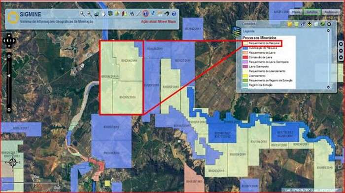
Uma vez definida a área livre em mapa, deve-se fazer o requerimento de pesquisa por meio do requerimento eletrônico REPEM (www.gov.br/anm/pt-br/assuntos/acesso-a-sistemas/pre-requerimento-eletronico-1).
A autorização de pesquisa define prazos e área máxima5 de acordo com o mineral pesquisado6 7. O objetivo dos trabalhos de pesquisa mineral é identificar uma eventual jazida, definir seus limites em volume (3D) e determinar a exequibilidade econômica/ambiental. É por meio do REPEM – Requerimento Eletrônico de Pesquisa Mineral que todos os procedimentos são executados.
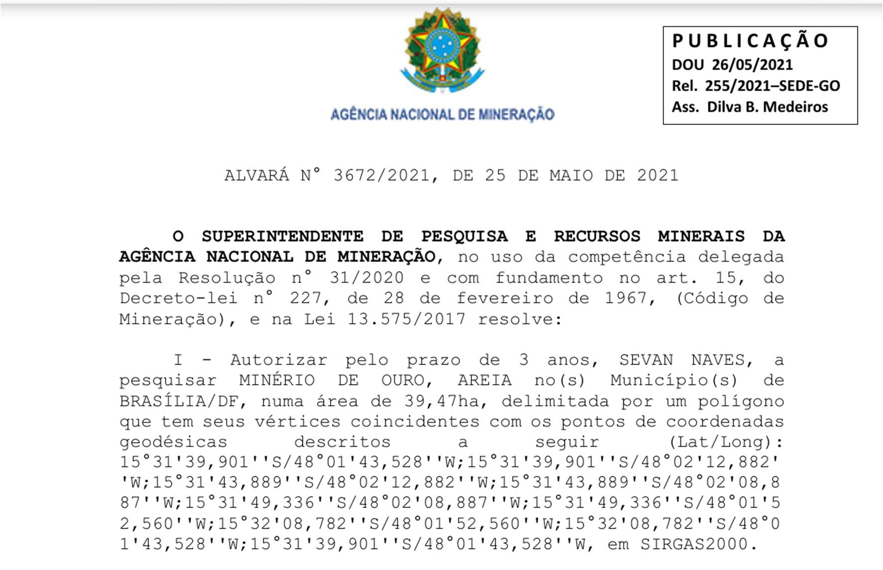
Uma vez obtido o requerimento de pesquisa, o titular tem 60 dias para iniciar os trabalhos de pesquisa e comunicar à ANM. Pode negociar, parcelar e até ceder os direitos a terceiros, desde que todas essas decisões sejam comunicadas à ANM.
Direitos e deveres de um permissionário8
Direitos:
- a) Cessão total ou parcial do título dos direitos de pesquisa9.
- b) Acesso à área, mesmo não sendo proprietário10.
- c) Prioridade no direito de concessão de lavra, caso o RFP seja positivo, com até um ano para requerer a concessão de lavra.
- d) Requerer o direito de aproveitamento da substância mineral (Guia de Utilização) mesmo durante o prazo de pesquisa, desde que tenha anuência da ANM11.
- e) Escolher o prazo de pesquisa (de 1 a 3 anos), independentemente da substância mineral requerida12.
Deveres:
- a) Iniciar os trabalhos de pesquisa em até 60 dias.
- b) Não suspender os trabalhos por mais de 90 dias corridos ou 120 dias alternados.
- c) Responder por eventuais danos, tanto ao superficiário quanto ao meio ambiente, durante os trabalhos de pesquisa.
- d) Executar os trabalhos de pesquisa exclusivamente dentro do perímetro permitido.
- e) Apresentar anualmente o DIPEM – Declaração de Investimento em Pesquisa Mineral até 30 de abril de cada ano (dipem.anm.gov.br).
- f) Pagar a taxa anual por hectare – TAH13 – R$ 4,94 (1 dólar) por hectare.
- g) Apresentar, ao final dos trabalhos de pesquisa e dentro do prazo do alvará de pesquisa, o Relatório Final de Pesquisa.
Áreas máximas
Fonte: legislação (www.dnpm-pe.gov.br/Legisla/CN_DNPM.htm#Art._42).
- 5 ha – para uso imediato na construção civil14 (II), desde que não haja comercialização; não são submetidos ao Código de Mineração15.
- 50 ha – águas potáveis de mesa (VIII), areia, feldspato, gemas (VI), mica, brita, corretivo de solo, areias e cascalhos para uso na construção civil.
- 1.000 ha – rochas para revestimento e demais (calcário, caulim); VII – asbesto.
- 2.000 ha – I – metálicos, IV – carvão/turfa, fertilizantes, diamante, III – sal-gema (evaporitos). Lei 5.173/66, artigo segundo.
- 10.000 ha – itens do grupo anterior, mais caulim na Amazônia Legal (todo o MT e a metade oeste do MA).
Período do alvará de pesquisa: de 1 a 3 anos, renovável por igual período em casos excepcionais.
Passo 2: Concessão de Lavra
Uma vez aprovado pela ANM o RFP – Relatório Final de Pesquisa positivo16 no passo anterior, o titular da autorização de pesquisa tem até um ano para apresentar o PAE – Plano de Aproveitamento Econômico da jazida17 e, caso aprovado, recebe o título de concessão de lavra do Ministro de Minas e Energia.
Direitos:
- a) O prazo da concessão, cumpridas as exigências legais, é, em tese, infinito18, enquanto durar a extração do minério, o que garante segurança jurídica.
- b) Pode, a qualquer momento, ceder parcial ou integralmente o título de concessão de lavra, desde que o novo cessionário possa cumprir as exigências assumidas anteriormente.
- c) Pode, caso assim entenda, exportar o recurso mineral extraído.
Deveres:
- a) Apresentar anualmente o RAL – Relatório Anual de Lavra (www.anm.gov.br/ral).
- b) Pagar a CFEM – Compensação Financeira pela Exploração Mineral, com alíquotas de 1% a 3,5%, dependendo do bem mineral explotado19.
- c) Apresentar o RAPP – Relatório Anual de Atividades Potencialmente Poluidoras ao IBAMA, além do pagamento anual da TCFA.
- d) Caso a lavra disponha de barragem de rejeito, apresentar anualmente à ANM o DCE – Declaração de Condição de Estabilidade de Barragens.
Passo 3: Extração
O passo mais ousado e caro, após a conclusão da pesquisa mineral, é a decisão de iniciar os trabalhos de extração da reserva que acabou de ser quantificada e qualificada pelos trabalhos das duas fases anteriores da Exploração Mineral. Porém, dependendo do tipo de minério, os trabalhos de exploração mineral continuam mesmo com a mina em atividade, pois é preciso encontrar novas jazidas, se possível, mas também pesquisar as melhores direções e profundidades para extrair o minério durante os trabalhos da lavra; ou seja, os trabalhos de exploração mineral continuam, agora com uma escala muito mais precisa.
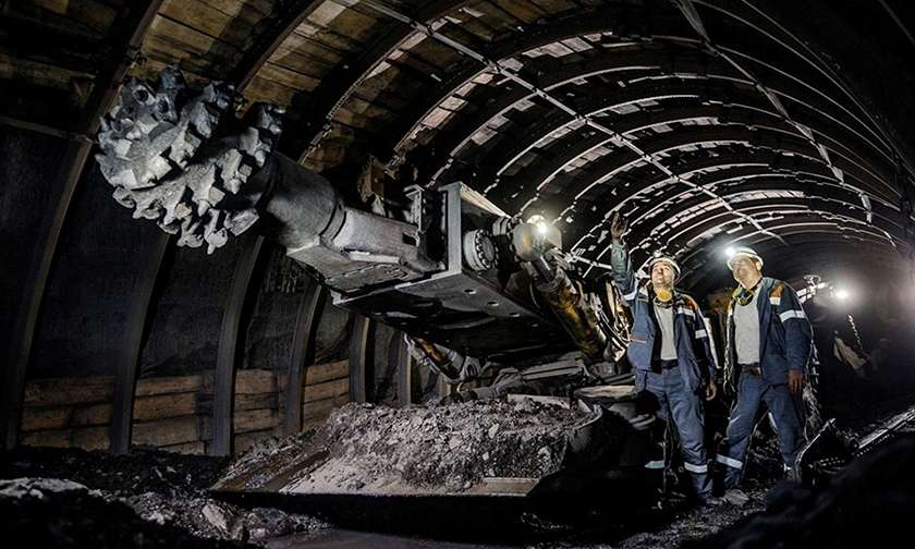
É nesta fase que se decide se a lavra será a céu aberto ou subterrânea, os cronogramas e a possível margem de lucro; é o momento de maior dispêndio de capital, pois é aqui que todas as instalações, tanto para a extração quanto para o tratamento do minério, serão instaladas.
É nesta etapa, em paralelo ao pedido de Concessão de Lavra, que se buscam as licenças ambientais prévia, de instalação e, por último, de operação, que são extremamente exigentes, demoradas e custosas, exigindo muitas vezes alteração no projeto já definido e alterando eventualmente o retorno econômico da futura lavra.
Passo 4: Descomissionamento
Plano de Fechamento de Mina. No mundo atual, não é mais possível imaginar20 o início de uma mina sem incluir os custos e a destinação, especialmente ambientais, da mina no momento do esgotamento e da desativação. Antes, a etapa final de uma mina era simplesmente o esgotamento dela e seu abandono; hoje, é a destinação final em condições possivelmente iguais ou até melhores21 do que antes da extração do recurso mineral. Essa etapa é denominada descomissionamento e envolve custos e prazos razoáveis, que não devem ser ignorados.
O instrumento de projeto de descomissionamento no Brasil, desde 1989, denomina-se PRAD – Plano de Recuperação de Áreas Degradadas, e esse documento deve ser entregue no momento do pedido de concessão de lavra, ou seja, dezenas de anos antes do fechamento da mina. Esse documento detalha todos os trabalhos futuros para que a lavra, que ainda nem entrou em produção, seja entregue no futuro em condições aceitáveis, com cronogramas que deverão ser seguidos e cobrados pelos órgãos ambientais.
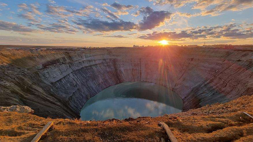
A lógica do descomissionamento é que o perímetro que outrora foi lavra possa ser reutilizado para qualquer outra atividade, inclusive lazer. A mineração é uma atividade econômica que, além de todos os impactos ambientais, impede, quando ativa, a visitação, e talvez essa seja uma das destinações mais nobres, especialmente quando é possível manter o lago dentro da cava22.
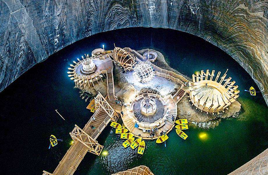
Porém, existem alguns tipos de lavras em que a destinação ao lazer é impraticável devido a impactos ambientais e estéticos irreversíveis. Neste caso, o empreendedor é responsável, inclusive assumindo os custos, por manter, mesmo depois da desativação da mina, uma estrutura de gerenciamento, pois em alguns casos deve-se até impedir o acesso aos arredores da mina abandonada.
Steps from Mineral Exploration to Mining Concession
Exploration permit, mining concession, extraction and decommissioning: what the law requires at each step.
Step 1: Exploration Application Permit
In Brazil, the body responsible for all authorisations, concessions, artisanal mining permits1, successive exploration authorisations2, inspection of tailings dams, payment of fees and charges associated with mining, and control of mining is the ANM3 – Agência Nacional de Mineração (National Mining Agency, www.anm.gov.br).
How to obtain the Exploration Application Permit
The first step is to apply for a defined, available4 area for exploration through the SIGMINE portal (geo.anm.gov.br/portal/home/index.html).
Once the free area has been defined on the map, the exploration application must be made through the electronic application REPEM (www.gov.br/anm/pt-br/assuntos/acesso-a-sistemas/pre-requerimento-eletronico-1).
The exploration authorisation defines terms and a maximum area5 according to the mineral being explored6 7. The aim of the mineral exploration work is to identify a possible deposit, define its limits in volume (3D) and determine economic/environmental feasibility. All procedures are carried out through REPEM – the Electronic Mineral Exploration Application.
Once the exploration permit is obtained, the holder has 60 days to start the exploration work and notify the ANM. The holder may negotiate, divide and even assign the rights to third parties, provided that all these decisions are communicated to the ANM.
Rights and duties of a permit holder8
Rights:
- a) Full or partial assignment of the title to the exploration rights9.
- b) Access to the area even if not the landowner10.
- c) Priority in the right to the mining concession if the RFP (Final Exploration Report) is positive, with up to one year to apply for the concession.
- d) To apply for the right to use the mineral substance (Utilisation Guide) even during the exploration period, provided it has the ANM’s consent11.
- e) To choose the exploration period (1 to 3 years), regardless of the mineral substance applied for12.
Duties:
- a) Start the exploration work within 60 days.
- b) Not suspend the work for more than 90 consecutive days or 120 alternating days.
- c) Answer for any damage, both to the surface landowner and to the environment, during the exploration work.
- d) Carry out the exploration work exclusively within the permitted perimeter.
- e) Submit the DIPEM – Declaration of Investment in Mineral Exploration – every year by 30 April (dipem.anm.gov.br).
- f) Pay the annual fee per hectare – TAH13 – R$ 4.94 (1 US dollar) per hectare.
- g) Submit the Final Exploration Report at the end of the exploration work and within the term of the exploration permit.
Maximum areas
Source: legislation (www.dnpm-pe.gov.br/Legisla/CN_DNPM.htm#Art._42).
- 5 ha – for immediate use in civil construction14 (II), provided there is no sale; not subject to the Mining Code15.
- 50 ha – drinking table waters (VIII), sand, feldspar, gemstones (VI), mica, crushed stone, soil conditioner, sands and gravels for use in civil construction.
- 1,000 ha – dimension and cladding stone and others (limestone, kaolin); VII – asbestos.
- 2,000 ha – I – metallic minerals, IV – coal/peat, fertilisers, diamond, III – rock salt (evaporites). Law 5,173/66, article two.
- 10,000 ha – items of the previous group, plus kaolin in the Legal Amazon (all of MT and the western half of MA).
Exploration permit period: 1 to 3 years, renewable for an equal period in exceptional cases.
Step 2: Mining Concession
Once the positive16 RFP – Final Exploration Report has been approved by the ANM in the previous step, the holder of the exploration authorisation has up to one year to submit the PAE – Economic Development Plan for the deposit17 and, if it is approved, receives the mining concession title from the Minister of Mines and Energy.
Rights:
- a) The term of the concession, once the legal requirements are met, is in theory unlimited18 for as long as ore extraction lasts, which guarantees legal certainty.
- b) The holder may at any time assign the mining concession title in part or in full, provided the new assignee can meet the requirements previously assumed.
- c) The holder may, if it so decides, export the extracted mineral resource.
Duties:
- a) Submit the RAL – Annual Mining Report – every year (www.anm.gov.br/ral).
- b) Pay the CFEM – Financial Compensation for Mineral Exploitation, at rates from 1% to 3.5%, depending on the mineral commodity mined19.
- c) Submit the RAPP – Annual Report of Potentially Polluting Activities – to IBAMA, in addition to paying the TCFA annually.
- d) If the mine has a tailings dam, submit the DCE – Dam Stability Condition Statement – to the ANM every year.
Step 3: Extraction
The boldest and most expensive step, once the mineral exploration is complete, is the decision to start extracting the reserve that has just been quantified and qualified by the work of the two previous phases of Mineral Exploration. Depending on the type of ore, however, mineral exploration work continues even with the mine in operation, because new deposits must be found where possible, and the best directions and depths for extracting the ore must also be researched during mining; that is, mineral exploration work goes on, now at a much more precise scale.
It is in this phase that it is decided whether mining will be open-pit or underground, along with the schedules and the possible profit margin; it is the moment of greatest capital expenditure, because this is where all the facilities, for both extraction and ore treatment, will be installed.
It is at this stage, in parallel with the application for the Mining Concession, that the environmental licences are sought: preliminary, installation and, last, operating, which are extremely demanding, slow and costly, often requiring changes to the project already defined and possibly altering the economic return of the future mine.
Step 4: Decommissioning
Mine Closure Plan. In today’s world it is no longer possible to imagine20 starting a mine without including the costs and the end use, especially environmental, of the mine at the time of depletion and closure. Previously, the final stage of a mine was simply its depletion and abandonment; today it is the final destination in conditions possibly equal to or even better21 than before the extraction of the mineral resource. This stage is called decommissioning and involves considerable costs and timelines that must not be ignored.
The decommissioning design instrument in Brazil, since 1989, is called the PRAD – Plan for the Recovery of Degraded Areas, and this document must be submitted when the mining concession is applied for, that is, decades before the mine closes. The document details all future work so that the mine, which has not even entered production yet, is handed back in the future in acceptable condition, with schedules that must be followed and enforced by the environmental bodies.
The logic of decommissioning is that the perimeter that was once a mine can be reused for any other activity, including leisure. Mining is an economic activity that, besides all its environmental impacts, prevents visits while active, and perhaps this is one of the noblest end uses, especially when it is possible to keep the lake inside the pit22.
However, there are some types of mines for which leisure use is impracticable because of irreversible environmental and aesthetic impacts. In this case the developer is responsible, including bearing the costs, for maintaining a management structure even after the mine has been shut down, since in some cases access to the surroundings of the abandoned mine must even be prevented.
Шаги от разведки до концессии на добычу
Разрешение на разведку, концессия на добычу, добыча и вывод из эксплуатации: что требует закон на каждом шаге.
Шаг 1. Разрешение на разведку
В Бразилии орган, отвечающий за все разрешения, концессии, разрешения на старательскую добычу1, последовательные разрешения на разведку2, надзор за хвостохранилищами, уплату сборов и пошлин, связанных с горным делом, и контроль горной деятельности, — это ANM3, Национальное агентство горнодобывающей промышленности (www.anm.gov.br).
Как получить разрешение на разведку
Первый шаг — подать заявку на определённый свободный4 участок для разведки через портал SIGMINE (geo.anm.gov.br/portal/home/index.html).
После того как свободный участок определён на карте, нужно подать заявку на разведку через электронную заявку REPEM (www.gov.br/anm/pt-br/assuntos/acesso-a-sistemas/pre-requerimento-eletronico-1).
Разрешение на разведку определяет сроки и максимальную площадь5 в зависимости от изучаемого минерала6 7. Цель разведочных работ — выявить возможное месторождение, определить его границы по объёму (3D) и установить экономическую и экологическую осуществимость. Все процедуры выполняются через REPEM — электронную заявку на минеральную разведку.
После получения разрешения на разведку у владельца есть 60 дней, чтобы начать работы и сообщить об этом в ANM. Он может вести переговоры, делить и даже передавать права третьим лицам при условии, что обо всех этих решениях сообщено в ANM.
Права и обязанности владельца разрешения8
Права:
- а) Полная или частичная уступка титула прав на разведку9.
- б) Доступ на участок, даже если вы не его собственник10.
- в) Приоритетное право на концессию на добычу, если RFP (итоговый отчёт о разведке) положительный; на подачу заявки на концессию отводится до одного года.
- г) Подать заявку на право использования полезного ископаемого (Guia de Utilização) даже в срок разведки при согласии ANM11.
- д) Выбрать срок разведки (от 1 до 3 лет) независимо от заявленного полезного ископаемого12.
Обязанности:
- а) Начать разведочные работы в течение 60 дней.
- б) Не приостанавливать работы более чем на 90 дней подряд или 120 дней с перерывами.
- в) Отвечать за возможный ущерб как собственнику поверхности, так и окружающей среде во время разведки.
- г) Вести разведочные работы только в пределах разрешённого периметра.
- д) Ежегодно, до 30 апреля, подавать DIPEM — декларацию об инвестициях в разведку (dipem.anm.gov.br).
- е) Платить ежегодный сбор за гектар — TAH13 — 4,94 реала (1 доллар США) за гектар.
- ж) По окончании разведки и в срок действия разрешения представить итоговый отчёт о разведке.
Максимальные площади
Источник: законодательство (www.dnpm-pe.gov.br/Legisla/CN_DNPM.htm#Art._42).
- 5 га — для непосредственного использования в гражданском строительстве14 (II) при отсутствии продажи; на них не распространяется Горный кодекс15.
- 50 га — питьевые столовые воды (VIII), песок, полевой шпат, самоцветы (VI), слюда, щебень, почвенные мелиоранты, пески и гравий для гражданского строительства.
- 1 000 га — облицовочные породы и прочие (известняк, каолин); VII — асбест.
- 2 000 га — I — металлические, IV — уголь/торф, удобрения, алмазы, III — каменная соль (эвапориты). Закон 5.173/66, статья вторая.
- 10 000 га — позиции предыдущей группы плюс каолин в Легальной Амазонии (весь штат МТ и западная половина МА).
Срок разрешения на разведку: от 1 до 3 лет, в исключительных случаях продлевается на такой же срок.
Шаг 2. Концессия на добычу
После того как ANM на предыдущем шаге одобрила положительный16 RFP — итоговый отчёт о разведке, владелец разрешения на разведку имеет до одного года, чтобы представить PAE — план экономического освоения месторождения17, и в случае одобрения получает титул концессии на добычу от министра горнодобывающей промышленности и энергетики.
Права:
- а) Срок концессии при соблюдении законных требований теоретически не ограничен18 — пока продолжается добыча руды, что гарантирует правовую определённость.
- б) В любой момент можно полностью или частично уступить титул концессии при условии, что новый правопреемник сможет выполнить ранее принятые требования.
- в) При желании можно экспортировать добытое полезное ископаемое.
Обязанности:
- а) Ежегодно подавать RAL — годовой отчёт о добыче (www.anm.gov.br/ral).
- б) Платить CFEM — финансовую компенсацию за добычу полезных ископаемых по ставкам от 1% до 3,5% в зависимости от добываемого ископаемого19.
- в) Подавать в IBAMA RAPP — годовой отчёт о потенциально загрязняющей деятельности, а также ежегодно платить TCFA.
- г) Если на руднике есть хвостохранилище, ежегодно подавать в ANM DCE — декларацию о состоянии устойчивости плотины.
Шаг 3. Добыча
Самый смелый и дорогой шаг после завершения разведки — решение начать добычу запаса, который только что был оценен количественно и качественно работами двух предыдущих фаз разведки. Однако в зависимости от типа руды разведочные работы продолжаются и при действующем руднике: нужно по возможности находить новые месторождения, а также выяснять лучшие направления и глубины отработки в ходе добычи; то есть разведка продолжается, но уже в гораздо более точном масштабе.
Именно на этой фазе решают, будет ли добыча открытой или подземной, а также графики и возможную маржу; это момент наибольших капитальных затрат, так как здесь устанавливаются все объекты — и для добычи, и для обогащения руды.
На этом этапе, параллельно с заявкой на концессию на добычу, получают экологические лицензии — предварительную, на строительство и, наконец, на эксплуатацию. Они чрезвычайно требовательны, долги и затратны, нередко требуют изменить уже определённый проект и могут изменить экономическую отдачу будущего рудника.
Шаг 4. Вывод из эксплуатации
План закрытия рудника. В современном мире уже нельзя представить20 начало рудника без учёта затрат и дальнейшего назначения территории, особенно экологического, к моменту исчерпания и закрытия. Раньше последним этапом рудника было просто его исчерпание и заброс; сегодня это конечное назначение в состоянии, возможно, не хуже, а то и лучше21, чем до добычи полезного ископаемого. Этот этап называется выводом из эксплуатации и требует немалых затрат и времени, которые нельзя игнорировать.
Проектный документ по выводу из эксплуатации в Бразилии с 1989 года называется PRAD — план восстановления нарушенных земель, и его нужно сдать в момент подачи заявки на концессию на добычу, то есть за десятки лет до закрытия рудника. В нём подробно описаны все будущие работы, чтобы рудник, который ещё даже не начал добычу, был сдан в будущем в приемлемом состоянии по графикам, которые должны соблюдаться и контролироваться природоохранными органами.
Логика вывода из эксплуатации в том, что территорию бывшего рудника можно использовать для любой другой деятельности, включая отдых. Горное дело — вид экономической деятельности, который помимо всех воздействий на природу ещё и исключает посещение, пока рудник работает; и это, возможно, одно из самых достойных назначений, особенно когда можно сохранить озеро внутри карьера22.
Однако есть типы рудников, для которых использование под отдых невозможно из-за необратимого воздействия на природу и ландшафт. В этом случае недропользователь отвечает за содержание структуры управления и несёт её расходы даже после закрытия рудника, поскольку в некоторых случаях нужно даже ограничивать доступ в окрестности заброшенного рудника.
Como a dinâmica terrestre gera uma mina
Artigo em preparação.
How Earth dynamics give rise to a mine
Article in preparation.
Как динамика Земли приводит к образованию месторождения
Статья готовится.